Weather Alert in California
Flood Advisory issued February 24 at 9:53PM PST until February 24 at 11:00PM PST by NWS Eureka CA
AREAS AFFECTED: Lake, CA; Mendocino, CA
DESCRIPTION: * WHAT...Urban area and small stream flooding caused by excessive rainfall continues. * WHERE...Lake County in central California... Mendocino County in northwestern California... * WHEN...Until 1100 PM PST. * IMPACTS...Minor flooding in low-lying and poor drainage areas. Water over roadways. Ponding of water in urban or other areas is occurring or is imminent. There will be an increased risk of rock and land slides along roadways. * ADDITIONAL DETAILS... - At 951 PM PST, Doppler radar and automated rain gauges indicated heavy rain. This is causing urban and small stream flooding. Between 1 and 5 inches of rain have fallen. - Lingering showers could bring rainfall amounts up to 0.1 inches. - Some locations that will experience flooding include... Ukiah, Lakeport, Point Arena, Ukiah Municipal Airport, Upper Lake, Middletown, Clearlake, Knobcone Camp, Hopland, Witter Springs, Saratoga Springs, North Lakeport, Boonville, Philo, Finley, Soda Bay, Mount Konocti, Glenhaven, Konocti Bay and Loch Lomond. - http://www.weather.gov/safety/flood
INSTRUCTION: Turn around, don't drown when encountering flooded roads. Most flood deaths occur in vehicles. Be especially cautious at night when it is harder to recognize the dangers of flooding. Be aware of your surroundings and do not drive on flooded roads.
Want more detail? Get the Complete 7 Day and Night Detailed Forecast!
Current U.S. National Radar--Current
The Current National Weather Radar is shown below with a UTC Time (subtract 5 hours from UTC to get Eastern Time).

National Weather Forecast--Current
The Current National Weather Forecast and National Weather Map are shown below.

National Weather Forecast for Tomorrow
Tomorrow National Weather Forecast and Tomorrow National Weather Map are show below.

North America Water Vapor (Moisture)
This map shows recent moisture content over North America. Bright and colored areas show high moisture (ie, clouds); brown indicates very little moisture present; black indicates no moisture.

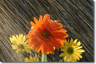
Weather Topic: What is Rain?
Home - Education - Precipitation - Rain
 Next Topic: Shelf Clouds
Precipitation in the form of water droplets is called rain.
Rain generally has a tendency to fall with less intensity over a greater period
of time, and when rainfall is more severe it is usually less sustained.
Rain is the most common form of precipitation and happens with greater frequency
depending on the season and regional influences. Cities have been shown to have
an observable effect on rainfall, due to an effect called the urban heat island.
Compared to upwind, monthly rainfall between twenty and forty miles downwind of
cities is 30% greater.
Next Topic: Shelf Clouds
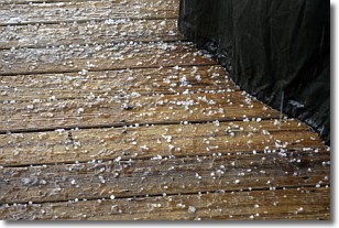
Weather Topic: What is Sleet?
Home - Education - Precipitation - Sleet
 Next Topic: Snow
Sleet is a form of precipitation in which small ice pellets are the primary
components. These ice pellets are smaller and more translucent than hailstones,
and harder than graupel. Sleet is caused by specific atmospheric conditions and
therefore typically doesn't last for extended periods of time.
The condition which leads to sleet formation requires a warmer body of air to be
wedged in between two sub-freezing bodies of air. When snow falls through a warmer
layer of air it melts, and as it falls through the next sub-freezing body of air
it freezes again, forming ice pellets known as sleet. In some cases, water
droplets don't have time to freeze before reaching the surface and the result is
freezing rain.
Next Topic: Snow
Current conditions powered by WeatherAPI.com


