Weather Alert in Colorado
Special Weather Statement issued July 30 at 5:39PM MDT by NWS Pueblo CO
AREAS AFFECTED: Central Chaffee County Below 9000 Ft; Western Mosquito Range/East Chaffee County above 9000Ft; Del Norte Vicinity/Northern San Luis Valley Below 8500 Ft; Northern Sangre de Cristo Mountains Between 8500 And 11000 Ft; Northern Sangre de Cristo Mountains above 11000 Ft; Northwestern Fremont County Above 8500Ft; Western/Central Fremont County Below 8500 Ft
DESCRIPTION: At 538 PM MDT, Doppler radar was tracking a cluster of strong thunderstorms along a line extending from 8 miles north of Swissvale to Salida. Movement was southeast at 10 mph. HAZARD...Wind gusts up to 50 mph, brief half inch hail, and torrential rainfall. SOURCE...Radar indicated. IMPACT...Gusty winds could knock down tree limbs and blow around unsecured objects. Minor hail damage to vegetation is possible. Locations impacted include... Salida, Poncha Springs, Howard, Coaldale, Waugh Mountain, Swissvale, Decker Burn Scar, and Poncha Pass.
INSTRUCTION: If outdoors, consider seeking shelter inside a building. Torrential rainfall is also occurring with these storms and may lead to localized flooding. Do not drive your vehicle through flooded roadways.
Want more detail? Get the Complete 7 Day and Night Detailed Forecast!
Current U.S. National Radar--Current
The Current National Weather Radar is shown below with a UTC Time (subtract 5 hours from UTC to get Eastern Time).

National Weather Forecast--Current
The Current National Weather Forecast and National Weather Map are shown below.

National Weather Forecast for Tomorrow
Tomorrow National Weather Forecast and Tomorrow National Weather Map are show below.

North America Water Vapor (Moisture)
This map shows recent moisture content over North America. Bright and colored areas show high moisture (ie, clouds); brown indicates very little moisture present; black indicates no moisture.

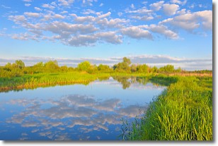
Weather Topic: What are Stratocumulus Clouds?
Home - Education - Cloud Types - Stratocumulus Clouds
 Next Topic: Stratus Clouds
Stratocumulus clouds are similar to altocumulus clouds in their
fluffy appearance, but have a slightly darker shade due to their additional mass.
A good way to distinguish the two cloud types is to hold your hand out and measure
the size of an individual cloud; if it is the size of your thumb it is generally
an altocumulus cloud, if it is the size of your hand it is generally a
stratocumulus cloud.
It is uncommon for stratocumulus clouds to produce precipitation, but if they do
it is usually a light rain or snow.
Next Topic: Stratus Clouds
Weather Topic: What are Wall Clouds?
Home - Education - Cloud Types - Wall Clouds
 Next Topic: Altocumulus Clouds
A wall cloud forms underneath the base of a cumulonimbus cloud,
and can be a hotbed for deadly tornadoes.
Wall clouds are formed by air flowing into the cumulonimbus clouds, which can
result in the wall cloud descending from the base of the cumulonimbus cloud, or
rising fractus clouds which join to the base of the storm cloud as the wall cloud
takes shape.
Wall clouds can be very large, and in the Northern Hemisphere they generally
form at the southern edge of cumulonimbus clouds.
Next Topic: Altocumulus Clouds
Current conditions powered by WeatherAPI.com


