Weather Alert in North Carolina
Flood Warning issued August 13 at 9:12PM EDT by NWS Wilmington NC
AREAS AFFECTED: Brunswick, NC; Columbus, NC; Horry, SC
DESCRIPTION: ...The Flood Warning is extended for the following rivers in North Carolina... Cape Fear River At William O Huske Lock And Dam 3 affecting Bladen and Cumberland Counties. ...The Flood Warning continues for the following rivers in South Carolina...North Carolina... Waccamaw River At Conway affecting Horry County. Waccamaw River near Longs affecting Columbus, Horry and Brunswick Counties. * WHAT...Minor flooding is occurring and minor flooding is forecast. * WHERE...Waccamaw River near Longs. * WHEN...Until further notice. * IMPACTS...At 13.0 feet, A few homes may be isolated by flood waters near the river at the end of Big Gutter Lane and Doodle Hill Lane. Flooding on Red Bluff Road worsens. The end of Vera Lane may be isolated by flood waters. Aberdeen Country Club parking lot may flood. In North Carolina, River Road in Pireway may begin to flood. * ADDITIONAL DETAILS... - At 9:00 PM EDT Wednesday the stage was 12.4 feet. - Forecast...The river is expected to rise to a crest of 12.7 feet early Friday morning. - Flood stage is 12.0 feet. - weather.gov/safety/flood
INSTRUCTION: Caution is urged when walking near riverbanks. Stay tuned to further developments by listening to your local radio, television, or NOAA Weather Radio for further information. Motorists should not attempt to drive around barricades or drive cars through flooded areas. Additional information is available at water.noaa.gov/wfo/ilm . The next statement will be issued by Thursday afternoon.
Want more detail? Get the Complete 7 Day and Night Detailed Forecast!
Current U.S. National Radar--Current
The Current National Weather Radar is shown below with a UTC Time (subtract 5 hours from UTC to get Eastern Time).

National Weather Forecast--Current
The Current National Weather Forecast and National Weather Map are shown below.

National Weather Forecast for Tomorrow
Tomorrow National Weather Forecast and Tomorrow National Weather Map are show below.

North America Water Vapor (Moisture)
This map shows recent moisture content over North America. Bright and colored areas show high moisture (ie, clouds); brown indicates very little moisture present; black indicates no moisture.

Weather Topic: What are Nimbostratus Clouds?
Home - Education - Cloud Types - Nimbostratus Clouds
 Next Topic: Precipitation
A nimbostratus cloud is similar to a stratus cloud in its formless,
smooth appearance. However, a nimbostratus cloud is darker than a stratus cloud,
because it is thicker.
Unlike a stratus cloud, a nimbostratus cloud typically brings with it the threat
of moderate to heavy precipitation. In some cases, the precipitation may evaporate
before reaching the ground, a phenomenon known as virga.
Next Topic: Precipitation
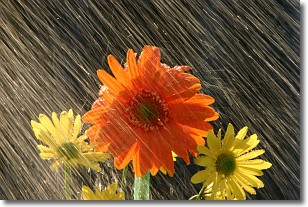
Weather Topic: What is Rain?
Home - Education - Precipitation - Rain
 Next Topic: Shelf Clouds
Precipitation in the form of water droplets is called rain.
Rain generally has a tendency to fall with less intensity over a greater period
of time, and when rainfall is more severe it is usually less sustained.
Rain is the most common form of precipitation and happens with greater frequency
depending on the season and regional influences. Cities have been shown to have
an observable effect on rainfall, due to an effect called the urban heat island.
Compared to upwind, monthly rainfall between twenty and forty miles downwind of
cities is 30% greater.
Next Topic: Shelf Clouds
Current conditions powered by WeatherAPI.com


