Weather Alert in Wisconsin
Winter Weather Advisory issued April 1 at 2:15PM CDT until April 2 at 10:00AM CDT by NWS La Crosse WI
AREAS AFFECTED: Trempealeau; La Crosse; Monroe; Juneau; Adams; Vernon; Richland
DESCRIPTION: ...FREEZING RAIN IMPACTS THE AREA TONIGHT INTO THURSDAY MORNING... .Freezing rain develops overnight and persists into Thursday morning, ending from south to north through the morning hours. Greatest ice accumulations are forecast along and north of Interstate 94 with icing amounts of a quarter to nearly half an inch possible in a few locations. Closer to Interstate 90, impacts vary more in space and time with ridge tops and bridges possibly seeing more impacts versus the valleys and ground. * WHAT...Freezing rain expected. Total ice accumulations around one to two tenths of an inch, locally higher amounts possible. Ice amounts and impacts could vary significantly between ridge tops and valleys. * WHERE...Portions of central, southwest, and west central Wisconsin. * WHEN...From midnight tonight to 10 AM CDT Thursday. * IMPACTS...Power outages and tree damage are likely due to the ice. Travel could be nearly impossible. The hazardous conditions could impact the Thursday morning commute.
INSTRUCTION: Slow down and use caution while traveling. Visit 511wi.gov for road conditions.
Want more detail? Get the Complete 7 Day and Night Detailed Forecast!
Current U.S. National Radar--Current
The Current National Weather Radar is shown below with a UTC Time (subtract 5 hours from UTC to get Eastern Time).

National Weather Forecast--Current
The Current National Weather Forecast and National Weather Map are shown below.

National Weather Forecast for Tomorrow
Tomorrow National Weather Forecast and Tomorrow National Weather Map are show below.

North America Water Vapor (Moisture)
This map shows recent moisture content over North America. Bright and colored areas show high moisture (ie, clouds); brown indicates very little moisture present; black indicates no moisture.

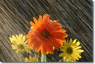
Weather Topic: What is Rain?
Home - Education - Precipitation - Rain
 Next Topic: Shelf Clouds
Precipitation in the form of water droplets is called rain.
Rain generally has a tendency to fall with less intensity over a greater period
of time, and when rainfall is more severe it is usually less sustained.
Rain is the most common form of precipitation and happens with greater frequency
depending on the season and regional influences. Cities have been shown to have
an observable effect on rainfall, due to an effect called the urban heat island.
Compared to upwind, monthly rainfall between twenty and forty miles downwind of
cities is 30% greater.
Next Topic: Shelf Clouds
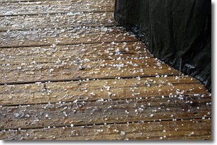
Weather Topic: What is Sleet?
Home - Education - Precipitation - Sleet
 Next Topic: Snow
Sleet is a form of precipitation in which small ice pellets are the primary
components. These ice pellets are smaller and more translucent than hailstones,
and harder than graupel. Sleet is caused by specific atmospheric conditions and
therefore typically doesn't last for extended periods of time.
The condition which leads to sleet formation requires a warmer body of air to be
wedged in between two sub-freezing bodies of air. When snow falls through a warmer
layer of air it melts, and as it falls through the next sub-freezing body of air
it freezes again, forming ice pellets known as sleet. In some cases, water
droplets don't have time to freeze before reaching the surface and the result is
freezing rain.
Next Topic: Snow
Current conditions powered by WeatherAPI.com


