Weather Alert in Alaska
High Wind Warning issued February 24 at 3:58PM AKST until February 25 at 9:00PM AKST by NWS Anchorage AK
AREAS AFFECTED: Kodiak Island Northeast
DESCRIPTION: * WHAT...Northwest winds 35 to 50 mph with gusts up to 75 mph expected. Wind chills dropping as low as 15 below zero Wednesday morning. * WHERE...Northeast end of Kodiak Island, including Kodiak City. * WHEN...From 3 AM to 9 PM AKST Wednesday. * IMPACTS...High winds could move loose debris, damage property, and cause power outages. Travel could be difficult. Wind chills as low as 15 below zero could result in hypothermia or frostbite if precautions are not taken. * ADDITIONAL DETAILS...The pattern remains very similar to last Thursday night when Kodiak City observed high winds, with cold Arctic air surging across Kodiak Island Tuesday night through Wednesday. While there is a subtle difference in the upper levels, with a disturbance passing just north of the island instead of passing overhead, wind gusts as high as 75 mph are forecast. The strongest winds are expected Wednesday morning, but elevated gusts will likely persist into Wednesday evening before diminishing late Wednesday night.
INSTRUCTION: People are urged to secure loose objects that could be blown around or damaged by the wind. Prepare for the possibility of widespread power outages. Use caution if you must drive.
Want more detail? Get the Complete 7 Day and Night Detailed Forecast!
Current U.S. National Radar--Current
The Current National Weather Radar is shown below with a UTC Time (subtract 5 hours from UTC to get Eastern Time).

National Weather Forecast--Current
The Current National Weather Forecast and National Weather Map are shown below.

National Weather Forecast for Tomorrow
Tomorrow National Weather Forecast and Tomorrow National Weather Map are show below.

North America Water Vapor (Moisture)
This map shows recent moisture content over North America. Bright and colored areas show high moisture (ie, clouds); brown indicates very little moisture present; black indicates no moisture.

Weather Topic: What are Hole Punch Clouds?
Home - Education - Cloud Types - Hole Punch Clouds
 Next Topic: Mammatus Clouds
A hole punch cloud is an unusual occurrence when a disk-shaped
hole appears in a cirrostratus, cirrocumulus, or altocumulus cloud.
When part of the cloud forms ice crystals, water droplets in the surrounding area
of the cloud evaporate. The effect of this process produces a large elliptical
gap in the cloud. The hole punch cloud formation is rare, but it is not specific
to any geographic area.
Other names which have been used to describe this phenomena include fallstreak hole,
skypunch, and cloud hole.
Next Topic: Mammatus Clouds
Weather Topic: What are Nimbostratus Clouds?
Home - Education - Cloud Types - Nimbostratus Clouds
 Next Topic: Precipitation
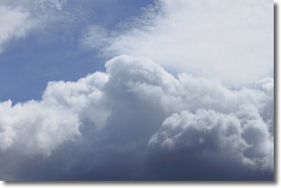
A nimbostratus cloud is similar to a stratus cloud in its formless,
smooth appearance. However, a nimbostratus cloud is darker than a stratus cloud,
because it is thicker.
Unlike a stratus cloud, a nimbostratus cloud typically brings with it the threat
of moderate to heavy precipitation. In some cases, the precipitation may evaporate
before reaching the ground, a phenomenon known as virga.
Next Topic: Precipitation
Current conditions powered by WeatherAPI.com


