Weather Alert in California
Flood Advisory issued February 24 at 3:10PM PST until February 25 at 6:27PM PST by NWS Reno NV
AREAS AFFECTED: Lassen, CA
DESCRIPTION: ...The National Weather Service in Reno has issued a Flood Advisory for the following rivers in California... Susan River At Susanville affecting Lassen County. For the Susan River near Susanville. Minor flooding is forecast. * WHAT...Minor flooding caused by rain and snowmelt is expected. * WHERE...Susan River at Susanville. * WHEN...From this evening to tomorrow night. * IMPACTS...At 12.0 feet, Flood Stage. Local flooding in Susanville from Lassen Street downstream along Riverside Drive...especially below Paiute Creek which enters river near Alexander Drive. Moderate lowland flooding below Susanville in Johnstonville... Leavitt Lake...Standish... and Litchfield areas. Some rural roads affected by flooding. While the gage is expected to fall quickly below flood stage impacts downstream near Standish will be delayed and more prolonged. * ADDITIONAL DETAILS... - At 2:30 PM PST Tuesday the stage was 7.4 feet. - Forecast...The river will rise to flood stage late this evening near midnight tonight. It will below flood stage at the gage early Wednesday morning. - Action stage is 10.5 feet. - Flood stage is 12.0 feet. - http://www.weather.gov/safety/flood
INSTRUCTION: If you are in the advisory area, remain alert to possible flooding or the possibility of the advisory being upgraded to a warning. Be cautions of nighttime flooding. Please report observed flooding to local emergency services or law enforcement and request they pass this information to the National Weather Service when you can do so safely. Additional information is available at www.weather.gov. The next statement will be issued Wednesday evening at 630 PM PST.
Want more detail? Get the Complete 7 Day and Night Detailed Forecast!
Current U.S. National Radar--Current
The Current National Weather Radar is shown below with a UTC Time (subtract 5 hours from UTC to get Eastern Time).

National Weather Forecast--Current
The Current National Weather Forecast and National Weather Map are shown below.

National Weather Forecast for Tomorrow
Tomorrow National Weather Forecast and Tomorrow National Weather Map are show below.

North America Water Vapor (Moisture)
This map shows recent moisture content over North America. Bright and colored areas show high moisture (ie, clouds); brown indicates very little moisture present; black indicates no moisture.

Weather Topic: What is Rain?
Home - Education - Precipitation - Rain
 Next Topic: Shelf Clouds
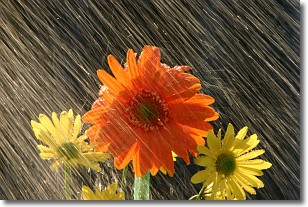
Precipitation in the form of water droplets is called rain.
Rain generally has a tendency to fall with less intensity over a greater period
of time, and when rainfall is more severe it is usually less sustained.
Rain is the most common form of precipitation and happens with greater frequency
depending on the season and regional influences. Cities have been shown to have
an observable effect on rainfall, due to an effect called the urban heat island.
Compared to upwind, monthly rainfall between twenty and forty miles downwind of
cities is 30% greater.
Next Topic: Shelf Clouds
Weather Topic: What is Sleet?
Home - Education - Precipitation - Sleet
 Next Topic: Snow
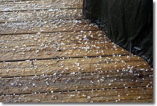
Sleet is a form of precipitation in which small ice pellets are the primary
components. These ice pellets are smaller and more translucent than hailstones,
and harder than graupel. Sleet is caused by specific atmospheric conditions and
therefore typically doesn't last for extended periods of time.
The condition which leads to sleet formation requires a warmer body of air to be
wedged in between two sub-freezing bodies of air. When snow falls through a warmer
layer of air it melts, and as it falls through the next sub-freezing body of air
it freezes again, forming ice pellets known as sleet. In some cases, water
droplets don't have time to freeze before reaching the surface and the result is
freezing rain.
Next Topic: Snow
Current conditions powered by WeatherAPI.com


