Weather Alert in Montana
Air Quality Alert issued September 2 at 9:03AM MDT by NWS Great Falls MT
AREAS AFFECTED: Daniels, MT; Dawson, MT; McCone, MT; Richland, MT; Roosevelt, MT; Sheridan, MT; Valley, MT
DESCRIPTION: AQAMT The Montana Department of Environmental Quality has issued an air quality alert for Daniels, Dawson, McCone, Richland, Roosevelt, Sheridan, Valley counties in effect until 9AM on 09/03/2025 An Air Quality Alert means that particulates have been trending upwards and that an exceedence of the 24 hour National Ambient Air Quality Standard (NAAQS) has occurred or may occur in the near future. Elevated particulate levels from wildfire smoke As of 8AM on 09/02/2025, particulate levels in Glendive are Unhealthy for Sensitive Groups. As of 8AM on 09/02/2025, particulate levels in Billings, Butte, Columbia Falls, Cut Bank, Frenchtown, Great Falls, Lewistown, Missoula, Seeley Lake, Sidney and Thompson Falls are Moderate. When air quality is Unhealthy for Sensitive Groups... State and local health officials recommend that people with respiratory or heart disease, the elderly and children should limit prolonged exertion. When air quality is Moderate... State and local health officials recommend that unusually sensitive people should consider reducing prolonged or heavy exertion. For more information visit the Montana Department of Environmental Quality at http://todaysair.mtdeq.us
INSTRUCTION: N/A
Want more detail? Get the Complete 7 Day and Night Detailed Forecast!
Current U.S. National Radar--Current
The Current National Weather Radar is shown below with a UTC Time (subtract 5 hours from UTC to get Eastern Time).

National Weather Forecast--Current
The Current National Weather Forecast and National Weather Map are shown below.

National Weather Forecast for Tomorrow
Tomorrow National Weather Forecast and Tomorrow National Weather Map are show below.

North America Water Vapor (Moisture)
This map shows recent moisture content over North America. Bright and colored areas show high moisture (ie, clouds); brown indicates very little moisture present; black indicates no moisture.

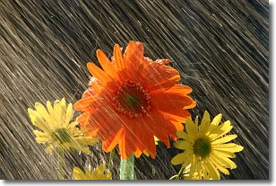
Weather Topic: What is Rain?
Home - Education - Precipitation - Rain
 Next Topic: Shelf Clouds
Precipitation in the form of water droplets is called rain.
Rain generally has a tendency to fall with less intensity over a greater period
of time, and when rainfall is more severe it is usually less sustained.
Rain is the most common form of precipitation and happens with greater frequency
depending on the season and regional influences. Cities have been shown to have
an observable effect on rainfall, due to an effect called the urban heat island.
Compared to upwind, monthly rainfall between twenty and forty miles downwind of
cities is 30% greater.
Next Topic: Shelf Clouds
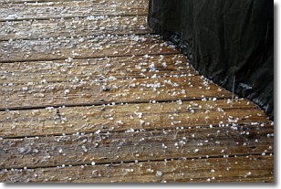
Weather Topic: What is Sleet?
Home - Education - Precipitation - Sleet
 Next Topic: Snow
Sleet is a form of precipitation in which small ice pellets are the primary
components. These ice pellets are smaller and more translucent than hailstones,
and harder than graupel. Sleet is caused by specific atmospheric conditions and
therefore typically doesn't last for extended periods of time.
The condition which leads to sleet formation requires a warmer body of air to be
wedged in between two sub-freezing bodies of air. When snow falls through a warmer
layer of air it melts, and as it falls through the next sub-freezing body of air
it freezes again, forming ice pellets known as sleet. In some cases, water
droplets don't have time to freeze before reaching the surface and the result is
freezing rain.
Next Topic: Snow
Current conditions powered by WeatherAPI.com


