Weather Alert in Washington
Red Flag Warning issued September 5 at 8:53PM PDT until September 7 at 3:00AM PDT by NWS Spokane WA
AREAS AFFECTED: East Washington Central Cascades; Central Washington Cascade Foothills; Waterville Plateau; Western Columbia Basin
DESCRIPTION: ...SCATTERED THUNDERSTORMS SATURDAY AFTERNOON INTO SATURDAY NIGHT... .Scattered thunderstorms will develop in the Cascades starting Saturday afternoon and expand into the western Columbia Basin during the evening and overnight hours with potential for abundant lightning. Storms will also be capable of gusty outflow winds of 30 to 40 mph. The National Weather Service in Spokane has issued a Red Flag Warning for thunderstorms, which is in effect from 4 PM Saturday to 3 AM PDT Sunday. * Affected Area: East Washington Central Cascades (Zone 696), Foothills of Central Washington Cascades (Zone 705), Waterville Plateau (Zone 706) and Western Columbia Basin (Zone 707). * Thunderstorms: Scattered thunderstorms with rainfall amounts between a trace and 0.15" * Outflow Winds: Gusty and erratic outflow winds of 30 to 40 mph. * Impacts: New fire starts are likely with thunderstorms. Gusty outflow winds may lead to fire spread with new or existing fires.
INSTRUCTION: A Red Flag Warning means that critical fire weather conditions are either occurring now....or will shortly. A combination of strong winds...low relative humidity...and warm temperatures can contribute to extreme fire behavior.
Want more detail? Get the Complete 7 Day and Night Detailed Forecast!
Current U.S. National Radar--Current
The Current National Weather Radar is shown below with a UTC Time (subtract 5 hours from UTC to get Eastern Time).

National Weather Forecast--Current
The Current National Weather Forecast and National Weather Map are shown below.

National Weather Forecast for Tomorrow
Tomorrow National Weather Forecast and Tomorrow National Weather Map are show below.

North America Water Vapor (Moisture)
This map shows recent moisture content over North America. Bright and colored areas show high moisture (ie, clouds); brown indicates very little moisture present; black indicates no moisture.

Weather Topic: What are Cumulus Clouds?
Home - Education - Cloud Types - Cumulus Clouds
 Next Topic: Drizzle
Cumulus clouds are fluffy and textured with rounded tops, and
may have flat bottoms. The border of a cumulus cloud
is clearly defined, and can have the appearance of cotton or cauliflower.
Cumulus clouds form at low altitudes (rarely above 2 km) but can grow very tall,
becoming cumulus congestus and possibly the even taller cumulonimbus clouds.
When cumulus clouds become taller, they have a greater chance of producing precipitation.
Next Topic: Drizzle
Weather Topic: What is Evaporation?
Home - Education - Precipitation - Evaporation
 Next Topic: Fog
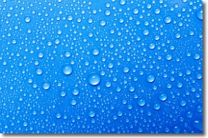
Evaporation is the process which returns water from the earth
back to the atmosphere, and is another crucial process in the water cycle.
Evaporation is the transformation of liquid into gas, and it happens because
molecules are excited by the application of energy and turn into vapor.
In order for water to evaporate it has to be on the surface of a body of water.
Next Topic: Fog
Current conditions powered by WeatherAPI.com


