Weather Alert in Michigan
Winter Storm Watch issued April 2 at 7:24PM CDT until April 4 at 10:00AM CDT by NWS Marquette MI
AREAS AFFECTED: Keweenaw; Ontonagon; Houghton; Southern Houghton
DESCRIPTION: * WHAT...For the Winter Storm Warning, heavy mixed precipitation. Additional snow and sleet accumulations between 2 and 4 inches and ice accumulations around one tenth of an inch, greatest ice accumulations south and greatest snow accumulations north. Winds gusting as high as 40 mph. For the Winter Storm Watch, heavy mixed precipitation possible. Total snow and sleet accumulations up to two inches and ice accumulations between one tenth and four tenths of an inch possible. Winds could gust as high as 35 mph. * WHERE...Keweenaw, Northern Houghton, Ontonagon, and Southern Houghton Counties. * WHEN...For the Winter Storm Warning, until 8 AM EDT Friday. For the Winter Storm Watch, from Friday evening through Saturday morning. * IMPACTS...Power outages and tree damage are possible due to the ice. Travel could be difficult. The hazardous conditions will impact the Thursday evening and Friday morning commutes. * ADDITIONAL DETAILS...Accumulating sleet will be difficult to remove.
INSTRUCTION: If you must travel, keep an extra flashlight, food, and water in your vehicle in case of an emergency. Prepare for possible power outages. Monitor the latest forecasts for updates on this situation.
Want more detail? Get the Complete 7 Day and Night Detailed Forecast!
Current U.S. National Radar--Current
The Current National Weather Radar is shown below with a UTC Time (subtract 5 hours from UTC to get Eastern Time).

National Weather Forecast--Current
The Current National Weather Forecast and National Weather Map are shown below.

National Weather Forecast for Tomorrow
Tomorrow National Weather Forecast and Tomorrow National Weather Map are show below.

North America Water Vapor (Moisture)
This map shows recent moisture content over North America. Bright and colored areas show high moisture (ie, clouds); brown indicates very little moisture present; black indicates no moisture.

Weather Topic: What are Cirrostratus Clouds?
Home - Education - Cloud Types - Cirrostratus Clouds
 Next Topic: Cirrus Clouds
Cirrostratus clouds are high, thin clouds that form above
20,000 feet and are made mostly of ice crystals. They sometimes look like giant
feathers, horse tails, or curls of hair in the sky.
These clouds are pushed by the jet stream and can move at high speeds reaching
100 mph.
What do they indicate?
They indicate that a precipitation is likely within 24 hours.
Next Topic: Cirrus Clouds
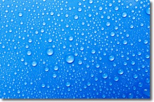
Weather Topic: What is Condensation?
Home - Education - Precipitation - Condensation
 Next Topic: Contrails
Condensation is the process which creates clouds, and therefore
it is a crucial process in the water cycle.
Condensation is the change of matter from a state of gas into a state of liquid,
and it happens because water molecules release heat into the atmosphere and
become organized into a more closely packed structure, what we might see as
water droplets.
Water is always present in the air around us as a vapor, but it's too small for
us to see. When water undergoes the process of condensation it becomes organized
into visible water droplets. You've probably seen condensation happen before on the
surface of a cold drink!
Next Topic: Contrails
Current conditions powered by WeatherAPI.com


