Weather Alert in California
Heat Advisory issued August 11 at 1:30AM PDT until August 12 at 9:00PM PDT by NWS Los Angeles/Oxnard CA
AREAS AFFECTED: Cuyama Valley; Santa Ynez Mountains Eastern Range; Santa Barbara County Interior Mountains; Southern Ventura County Mountains; Northern Ventura County Mountains; Interstate 5 Corridor; Western San Gabriel Mountains and Highway 14 Corridor; Eastern San Gabriel Mountains
DESCRIPTION: * WHAT...Daytime high temperatures in the 80s and 90s at high elevation to the mid 90s to near 105 degrees in the foothills and high valleys. Overnight low temperatures will be in the 70s to low 80s. * WHERE...Cuyama Valley, Eastern San Gabriel Mountains, Interstate 5 Corridor, Northern Ventura County Mountains, Santa Barbara County Interior Mountains, Santa Ynez Mountains Eastern Range, Southern Ventura County Mountains, and Western San Gabriel Mountains and Highway 14 Corridor. * WHEN...Until 9 PM PDT Tuesday. * IMPACTS...There is a high risk for heat illness for sensitive populations including the very young, the very old, those without air conditioning, and those active outdoors.
INSTRUCTION: Drink plenty of fluids, stay in an air-conditioned room, stay out of the sun, and check up on relatives and neighbors. Take extra precautions when outside. Wear lightweight and loose fitting clothing. Try to limit strenuous activities to early morning or evening. Take action when you see symptoms of heat exhaustion and heat stroke. To reduce risk during outdoor work, the Occupational Safety and Health Administration recommends scheduling frequent rest breaks in shaded or air conditioned environments. Anyone overcome by heat should be moved to a cool and shaded location. Heat stroke is an emergency! Call 9 1 1.
Want more detail? Get the Complete 7 Day and Night Detailed Forecast!
Current U.S. National Radar--Current
The Current National Weather Radar is shown below with a UTC Time (subtract 5 hours from UTC to get Eastern Time).

National Weather Forecast--Current
The Current National Weather Forecast and National Weather Map are shown below.

National Weather Forecast for Tomorrow
Tomorrow National Weather Forecast and Tomorrow National Weather Map are show below.

North America Water Vapor (Moisture)
This map shows recent moisture content over North America. Bright and colored areas show high moisture (ie, clouds); brown indicates very little moisture present; black indicates no moisture.

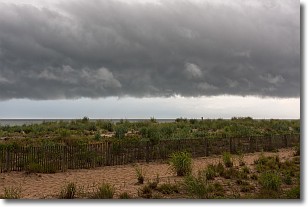
Weather Topic: What are Shelf Clouds?
Home - Education - Cloud Types - Shelf Clouds
 Next Topic: Sleet
A shelf cloud is similar to a wall cloud, but forms at the front
of a storm cloud, instead of at the rear, where wall clouds form.
A shelf cloud is caused by a series of events set into motion by the advancing
storm; first, cool air settles along the ground where precipitation has just fallen.
As the cool air is brought in, the warmer air is displaced, and rises above it,
because it is less dense. When the warmer air reaches the bottom of the storm cloud,
it begins to cool again, and the resulting condensation is a visible shelf cloud.
Next Topic: Sleet
Weather Topic: What is Snow?
Home - Education - Precipitation - Snow
 Next Topic: Stratocumulus Clouds
Snow is precipitation taking the form of ice crystals. Each ice crystal, or snowflake,
has unique characteristics, but all of them grow in a hexagonal structure.
Snowfall can last for sustained periods of time and result in significant buildup
of snow on the ground.
On the earth's surface, snow starts out light and powdery, but as it begins to melt
it tends to become more granular, producing small bits of ice which have the consistency of
sand. After several cycles of melting and freezing, snow can become very dense
and ice-like, commonly known as snow pack.
Next Topic: Stratocumulus Clouds
Current conditions powered by WeatherAPI.com


