Weather Alert in Alaska
Flood Watch issued August 1 at 3:10PM AKDT until August 4 at 3:00PM AKDT by NWS Anchorage AK
AREAS AFFECTED: Lower Matanuska Valley; Sutton / Upper Matanuska Valley; Eureka / Tahneta Pass
DESCRIPTION: * WHAT...Flooding caused by excessive rainfall is possible. * WHERE...The lower Matanuska River near Butte and Palmer as well as small rivers and streams between Sutton and Eureka. * WHEN...From 7 PM AKDT this evening through Monday afternoon. * IMPACTS...Heavy rainfall will lead to rapid runoff and rises in small streams draining the steep terrain along the Glenn Highway between Sutton and Eureka. Landslides are possible in landslide-prone areas along this corridor. Significant runoff is also expected to raise water levels on the Matanuska River, with some locations approaching bankfull by early Sunday morning. River levels may approach or even exceed those observed in early July, with increased bank erosion expected along the lower Matanuska River. While water levels may rise in small streams and rivers across the Matanuska-Susitna Valley, flooding is not expected west of the lower Matanuska River. * ADDITIONAL DETAILS... - Rainfall is expected to move from east to west across the Copper River Basin beginning tonight and lasting through Sunday morning. Projected rainfall totals with this storm are likely around 1 to 2 inches from Mendeltna to Sutton. Precipitation will become enhanced near terrain and along the northeast facing slopes of the Talkeetna and Chugach mountains. The heaviest rainfall is expected within the mountainous terrain along the Glenn Highway corridor between Sutton and Eureka. Ponding of water on roadways and erosion of unpaved surfaces is also possible. The Matanuska River at Palmer (MATA2) is expected to crest Sunday morning at 25100 cfs, which is below minor flood stage (30000 cfs). - Http://www.weather.gov/safety/flood - If you live near or along the Matanuska River, stay alert and be prepared to take action. - All residents on or near mountain slopes should be prepared for possible landslides.
INSTRUCTION: Persons living along streams should stay alert and be prepared to take action if a warning or advisory is issued, or flooding is observed. You should monitor later forecasts and be alert for possible Flood Warnings. Those living in areas prone to flooding should be prepared to take action should flooding develop. Stay tuned to further developments by listening to your local radio, television, or NOAA Weather Radio for further information. Reports on river conditions can be sent to the River Forecast Center by calling 1-800-847-1739
Want more detail? Get the Complete 7 Day and Night Detailed Forecast!
Current U.S. National Radar--Current
The Current National Weather Radar is shown below with a UTC Time (subtract 5 hours from UTC to get Eastern Time).

National Weather Forecast--Current
The Current National Weather Forecast and National Weather Map are shown below.

National Weather Forecast for Tomorrow
Tomorrow National Weather Forecast and Tomorrow National Weather Map are show below.

North America Water Vapor (Moisture)
This map shows recent moisture content over North America. Bright and colored areas show high moisture (ie, clouds); brown indicates very little moisture present; black indicates no moisture.

Weather Topic: What is Evaporation?
Home - Education - Precipitation - Evaporation
 Next Topic: Fog
Evaporation is the process which returns water from the earth
back to the atmosphere, and is another crucial process in the water cycle.
Evaporation is the transformation of liquid into gas, and it happens because
molecules are excited by the application of energy and turn into vapor.
In order for water to evaporate it has to be on the surface of a body of water.
Next Topic: Fog
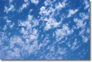
Weather Topic: What are Fractus Clouds?
Home - Education - Cloud Types - Fractus Clouds
 Next Topic: Freezing Rain
A fractus cloud (scud) is a fragmented, tattered cloud which has
likely been sheared off of another cloud. They are accessory clouds, meaning they
develop from parent clouds, and are named in a way which describes the original
cloud which contained them.
Fractus clouds which have originated from cumulus clouds are referred to as
cumulus fractus, while fractus clouds which have originated from stratus clouds
are referred to as stratus fractus. Under certain conditions a fractus cloud might
merge with another cloud, or develop into a cumulus cloud, but usually a
fractus cloud seen by itself will dissipate rapidly.
They are often observed on the leading and trailing edges of storm clouds,
and are a display of wind activity.
Next Topic: Freezing Rain
Current conditions powered by WeatherAPI.com


