Weather Alert in Nebraska
Flood Warning issued September 1 at 1:18PM CDT until September 3 at 1:00AM CDT by NWS Omaha/Valley NE
AREAS AFFECTED: Saunders, NE
DESCRIPTION: * WHAT...Flooding caused by excessive rainfall is expected. * WHERE...A portion of east central Nebraska, including the following county, Saunders. * WHEN...Until 100 AM CDT Wednesday. * IMPACTS...Flooding of rivers, creeks, streams, and other low-lying and flood-prone locations is imminent or occurring. Streams continue to rise due to excess runoff from earlier rainfall. * ADDITIONAL DETAILS... - At 115 PM CDT, Heavy rainfall this morning with lingering showers into the afternoon has led to a rapid rise on the Wahoo Creek. Downstream flooding is likely along the creek today, potentially affecting parts north of Weston and south of Wahoo. Flooding of county roads is possible. - Some locations that will experience flooding include... Wahoo and Weston.
INSTRUCTION: Turn around, don't drown when encountering flooded roads. Most flood deaths occur in vehicles.
Want more detail? Get the Complete 7 Day and Night Detailed Forecast!
Current U.S. National Radar--Current
The Current National Weather Radar is shown below with a UTC Time (subtract 5 hours from UTC to get Eastern Time).

National Weather Forecast--Current
The Current National Weather Forecast and National Weather Map are shown below.

National Weather Forecast for Tomorrow
Tomorrow National Weather Forecast and Tomorrow National Weather Map are show below.

North America Water Vapor (Moisture)
This map shows recent moisture content over North America. Bright and colored areas show high moisture (ie, clouds); brown indicates very little moisture present; black indicates no moisture.

Weather Topic: What are Cumulus Clouds?
Home - Education - Cloud Types - Cumulus Clouds
 Next Topic: Drizzle
Cumulus clouds are fluffy and textured with rounded tops, and
may have flat bottoms. The border of a cumulus cloud
is clearly defined, and can have the appearance of cotton or cauliflower.
Cumulus clouds form at low altitudes (rarely above 2 km) but can grow very tall,
becoming cumulus congestus and possibly the even taller cumulonimbus clouds.
When cumulus clouds become taller, they have a greater chance of producing precipitation.
Next Topic: Drizzle
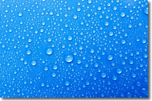
Weather Topic: What is Evaporation?
Home - Education - Precipitation - Evaporation
 Next Topic: Fog
Evaporation is the process which returns water from the earth
back to the atmosphere, and is another crucial process in the water cycle.
Evaporation is the transformation of liquid into gas, and it happens because
molecules are excited by the application of energy and turn into vapor.
In order for water to evaporate it has to be on the surface of a body of water.
Next Topic: Fog
Current conditions powered by WeatherAPI.com


