Weather Alert in Maine
Special Weather Statement issued March 30 at 8:28PM EDT by NWS Caribou ME
AREAS AFFECTED: Northwest Aroostook; Northeast Aroostook
DESCRIPTION: At 827 PM EDT...An area of heavy snow showers was along a line extending from 18 miles northeast of Van Buren to near Cross Lake to near Allagash...and moving southeast at 25 MPH. Locations impacted include... Caribou, Madawaska, Fort Fairfield, Limestone, Van Buren, Eagle Lake, Allagash, Deboullie Mountain, Washburn, Woodland, Portage Lake, New Canada, Cross Lake, Loring, Madawaska Lake, Fish River Lake, Allagash Township, New Sweden, Wallagrass, and Grand Isle. This includes the following highways... US Highway 1 between Caribou and Van Buren. State Highway 11 between Winterville and Eagle Lake. * Winds in excess of 30 mph are possible with this area of heavy snow showers. * Visibilities will drop quickly to less than a half mile in this area of heavy snow showers. Conditions can deteriorate rapidly in winter weather situations. Be prepared for snow or ice covered roads. Slow down and allow extra time when traveling.
INSTRUCTION: N/A
Want more detail? Get the Complete 7 Day and Night Detailed Forecast!
Current U.S. National Radar--Current
The Current National Weather Radar is shown below with a UTC Time (subtract 5 hours from UTC to get Eastern Time).

National Weather Forecast--Current
The Current National Weather Forecast and National Weather Map are shown below.

National Weather Forecast for Tomorrow
Tomorrow National Weather Forecast and Tomorrow National Weather Map are show below.

North America Water Vapor (Moisture)
This map shows recent moisture content over North America. Bright and colored areas show high moisture (ie, clouds); brown indicates very little moisture present; black indicates no moisture.

Weather Topic: What is Sleet?
Home - Education - Precipitation - Sleet
 Next Topic: Snow
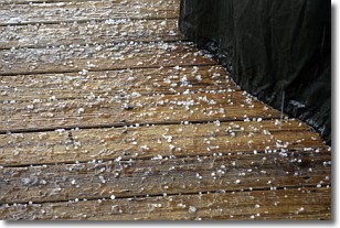
Sleet is a form of precipitation in which small ice pellets are the primary
components. These ice pellets are smaller and more translucent than hailstones,
and harder than graupel. Sleet is caused by specific atmospheric conditions and
therefore typically doesn't last for extended periods of time.
The condition which leads to sleet formation requires a warmer body of air to be
wedged in between two sub-freezing bodies of air. When snow falls through a warmer
layer of air it melts, and as it falls through the next sub-freezing body of air
it freezes again, forming ice pellets known as sleet. In some cases, water
droplets don't have time to freeze before reaching the surface and the result is
freezing rain.
Next Topic: Snow
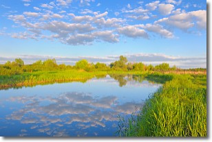
Weather Topic: What are Stratocumulus Clouds?
Home - Education - Cloud Types - Stratocumulus Clouds
 Next Topic: Stratus Clouds
Stratocumulus clouds are similar to altocumulus clouds in their
fluffy appearance, but have a slightly darker shade due to their additional mass.
A good way to distinguish the two cloud types is to hold your hand out and measure
the size of an individual cloud; if it is the size of your thumb it is generally
an altocumulus cloud, if it is the size of your hand it is generally a
stratocumulus cloud.
It is uncommon for stratocumulus clouds to produce precipitation, but if they do
it is usually a light rain or snow.
Next Topic: Stratus Clouds
Current conditions powered by WeatherAPI.com


