Weather Alert in New Mexico
Severe Thunderstorm Warning issued August 11 at 2:58PM MDT until August 11 at 3:45PM MDT by NWS Albuquerque NM
AREAS AFFECTED: San Miguel, NM
DESCRIPTION: SVRABQ The National Weather Service in Albuquerque has issued a * Severe Thunderstorm Warning for... Northwestern San Miguel County in northeastern New Mexico... * Until 345 PM MDT. * At 258 PM MDT, a severe thunderstorm was located near El Porvenir, or 8 miles northwest of Las Vegas, moving southeast at 20 mph. HAZARD...60 mph wind gusts and quarter size hail. SOURCE...Radar indicated. IMPACT...Hail damage to vehicles is expected. Expect wind damage to roofs, siding, and trees. * Locations impacted include... Las Vegas, Storrie Lake State Park, Romeroville, Montezuma, El Porvenir, Ojitos Frios, San Agustin, Gallinas, San Geronimo and Mineral Hill. This includes the following highways... State Road 518 between Mile Markers 1 and 8. State Road 283 between Mile Markers 1 and 12...and near Mile Marker 14. Interstate 25 between Mile Markers 337 and 353. State Road 65 between Mile Markers 1 and 13. State Road 104 between Mile Markers 1 and 12.
INSTRUCTION: Seek shelter inside a well-built structure and stay away from windows. This storm is capable of producing damaging winds and large hail.
Want more detail? Get the Complete 7 Day and Night Detailed Forecast!
Current U.S. National Radar--Current
The Current National Weather Radar is shown below with a UTC Time (subtract 5 hours from UTC to get Eastern Time).

National Weather Forecast--Current
The Current National Weather Forecast and National Weather Map are shown below.

National Weather Forecast for Tomorrow
Tomorrow National Weather Forecast and Tomorrow National Weather Map are show below.

North America Water Vapor (Moisture)
This map shows recent moisture content over North America. Bright and colored areas show high moisture (ie, clouds); brown indicates very little moisture present; black indicates no moisture.

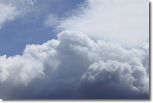
Weather Topic: What are Nimbostratus Clouds?
Home - Education - Cloud Types - Nimbostratus Clouds
 Next Topic: Precipitation
A nimbostratus cloud is similar to a stratus cloud in its formless,
smooth appearance. However, a nimbostratus cloud is darker than a stratus cloud,
because it is thicker.
Unlike a stratus cloud, a nimbostratus cloud typically brings with it the threat
of moderate to heavy precipitation. In some cases, the precipitation may evaporate
before reaching the ground, a phenomenon known as virga.
Next Topic: Precipitation
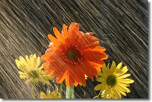
Weather Topic: What is Rain?
Home - Education - Precipitation - Rain
 Next Topic: Shelf Clouds
Precipitation in the form of water droplets is called rain.
Rain generally has a tendency to fall with less intensity over a greater period
of time, and when rainfall is more severe it is usually less sustained.
Rain is the most common form of precipitation and happens with greater frequency
depending on the season and regional influences. Cities have been shown to have
an observable effect on rainfall, due to an effect called the urban heat island.
Compared to upwind, monthly rainfall between twenty and forty miles downwind of
cities is 30% greater.
Next Topic: Shelf Clouds
Current conditions powered by WeatherAPI.com


