Weather Alert in Kansas
Flood Warning issued September 10 at 6:49PM CDT until September 13 at 3:00PM CDT by NWS Topeka KS
AREAS AFFECTED: Ottawa, KS
DESCRIPTION: ...The Flood Warning continues for the following rivers in Kansas... Salt Creek near Ada affecting Ottawa County. * WHAT...Moderate flooding is occurring and moderate flooding is forecast. This approaches the flood of record. * WHERE...Salt Creek near Ada. * WHEN...Until Saturday afternoon. * IMPACTS...At 18.0 feet, Minor low land flooding along the Salt Creek. At 20.0 feet, 50th Road just south of the bridge over the Salt Creek floods. At 20.2 feet, Deck of 50th Road bridge over the Salt Creek floods. At 21.0 feet, Flood waters are over one half mile wide over cultivated farm land 3 miles east southeast of the town of Ada. * ADDITIONAL DETAILS... - At 5:45 PM CDT Wednesday the stage was 21.7 feet. - Forecast...The river is expected to fall below flood stage early Saturday morning and continue falling to 14.5 feet early Monday afternoon. - Flood stage is 18.0 feet.
INSTRUCTION: Motorists should not attempt to drive around barricades or drive cars through flooded areas. This product along with additional weather and stream information is available at www.weather.gov/top/.
Want more detail? Get the Complete 7 Day and Night Detailed Forecast!
Current U.S. National Radar--Current
The Current National Weather Radar is shown below with a UTC Time (subtract 5 hours from UTC to get Eastern Time).

National Weather Forecast--Current
The Current National Weather Forecast and National Weather Map are shown below.

National Weather Forecast for Tomorrow
Tomorrow National Weather Forecast and Tomorrow National Weather Map are show below.

North America Water Vapor (Moisture)
This map shows recent moisture content over North America. Bright and colored areas show high moisture (ie, clouds); brown indicates very little moisture present; black indicates no moisture.

Weather Topic: What are Cumulus Clouds?
Home - Education - Cloud Types - Cumulus Clouds
 Next Topic: Drizzle
Cumulus clouds are fluffy and textured with rounded tops, and
may have flat bottoms. The border of a cumulus cloud
is clearly defined, and can have the appearance of cotton or cauliflower.
Cumulus clouds form at low altitudes (rarely above 2 km) but can grow very tall,
becoming cumulus congestus and possibly the even taller cumulonimbus clouds.
When cumulus clouds become taller, they have a greater chance of producing precipitation.
Next Topic: Drizzle
Weather Topic: What is Evaporation?
Home - Education - Precipitation - Evaporation
 Next Topic: Fog
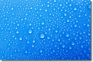
Evaporation is the process which returns water from the earth
back to the atmosphere, and is another crucial process in the water cycle.
Evaporation is the transformation of liquid into gas, and it happens because
molecules are excited by the application of energy and turn into vapor.
In order for water to evaporate it has to be on the surface of a body of water.
Next Topic: Fog
Current conditions powered by WeatherAPI.com


