Weather Alert in California
Heat Advisory issued August 21 at 6:25AM PDT until August 22 at 10:00PM PDT by NWS San Francisco CA
AREAS AFFECTED: Santa Cruz Mountains
DESCRIPTION: * WHAT...Daytime temperatures in the 90s with nighttime temperatures ranging from upper 50s in San Mateo County to mid 70s along the ridge. * WHERE...The Santa Cruz Mountains. * WHEN...From 10 AM this morning to 10 PM PDT Friday. * IMPACTS...Hot conditions can cause heat illnesses. This level of heat affects most individuals sensitive to heat, especially those without effective cooling and/or adequate hydration. Impacts possible in some health systems and in heat-sensitive industries.
INSTRUCTION: Hydration is a critical piece to surviving the heat. Drink water, and if possible, take water to those who are vulnerable. Beat the heat and check the backseat! Do not leave young children or pets in unattended vehicles.Car interiors will reach lethal temperatures in a matter of minutes. Stay cool, stay hydrated, stay informed.
Want more detail? Get the Complete 7 Day and Night Detailed Forecast!
Current U.S. National Radar--Current
The Current National Weather Radar is shown below with a UTC Time (subtract 5 hours from UTC to get Eastern Time).

National Weather Forecast--Current
The Current National Weather Forecast and National Weather Map are shown below.

National Weather Forecast for Tomorrow
Tomorrow National Weather Forecast and Tomorrow National Weather Map are show below.

North America Water Vapor (Moisture)
This map shows recent moisture content over North America. Bright and colored areas show high moisture (ie, clouds); brown indicates very little moisture present; black indicates no moisture.

Weather Topic: What are Cumulus Clouds?
Home - Education - Cloud Types - Cumulus Clouds
 Next Topic: Drizzle
Cumulus clouds are fluffy and textured with rounded tops, and
may have flat bottoms. The border of a cumulus cloud
is clearly defined, and can have the appearance of cotton or cauliflower.
Cumulus clouds form at low altitudes (rarely above 2 km) but can grow very tall,
becoming cumulus congestus and possibly the even taller cumulonimbus clouds.
When cumulus clouds become taller, they have a greater chance of producing precipitation.
Next Topic: Drizzle
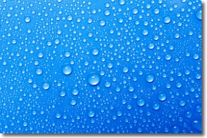
Weather Topic: What is Evaporation?
Home - Education - Precipitation - Evaporation
 Next Topic: Fog
Evaporation is the process which returns water from the earth
back to the atmosphere, and is another crucial process in the water cycle.
Evaporation is the transformation of liquid into gas, and it happens because
molecules are excited by the application of energy and turn into vapor.
In order for water to evaporate it has to be on the surface of a body of water.
Next Topic: Fog
Current conditions powered by WeatherAPI.com


