Weather Alert in Arizona
Flood Watch issued August 25 at 2:35AM MST until August 25 at 7:00PM MST by NWS Tucson AZ
AREAS AFFECTED: Western Pima County Including Ajo/Organ Pipe Cactus National Monument; Tohono O'odham Nation including Sells; Upper Santa Cruz River and Altar Valleys including Nogales; Tucson Metro Area including Tucson/Green Valley/Marana/Vail; South Central Pinal County including Eloy/Picacho Peak State Park; Santa Catalina and Rincon Mountains including Mount Lemmon/Summerhaven; Baboquivari Mountains including Kitt Peak
DESCRIPTION: * WHAT...Scattered showers and thunderstorms will be developing early this afternoon across eastern Pima and Santa Cruz counties and push to the west northwest across the lower deserts of Pima and south-central Pinal county. Some of these thunderstorms will be capable of producing very heavy rain in a short period of time leading to the potential of flash flooding. * WHERE...A portion of Southeast Arizona, including the following areas, Baboquivari Mountains, Catalina and Rincon Mountains, South Central Pinal County, Tohono O'odham Nation, Tucson Metro Area, Upper Santa Cruz River Valley/Altar Valley and Western Pima County. * WHEN...From 1 PM MST this afternoon through this evening. * IMPACTS...Excessive runoff may result in flooding of rivers, creeks, streams, and other low-lying and flood-prone locations. * ADDITIONAL DETAILS... - http://www.weather.gov/safety/flood
INSTRUCTION: You should monitor later forecasts and be alert for possible Flood Warnings. Those living in areas prone to flooding should be prepared to take action should flooding develop.
Want more detail? Get the Complete 7 Day and Night Detailed Forecast!
Current U.S. National Radar--Current
The Current National Weather Radar is shown below with a UTC Time (subtract 5 hours from UTC to get Eastern Time).

National Weather Forecast--Current
The Current National Weather Forecast and National Weather Map are shown below.

National Weather Forecast for Tomorrow
Tomorrow National Weather Forecast and Tomorrow National Weather Map are show below.

North America Water Vapor (Moisture)
This map shows recent moisture content over North America. Bright and colored areas show high moisture (ie, clouds); brown indicates very little moisture present; black indicates no moisture.

Weather Topic: What are Hole Punch Clouds?
Home - Education - Cloud Types - Hole Punch Clouds
 Next Topic: Mammatus Clouds
A hole punch cloud is an unusual occurrence when a disk-shaped
hole appears in a cirrostratus, cirrocumulus, or altocumulus cloud.
When part of the cloud forms ice crystals, water droplets in the surrounding area
of the cloud evaporate. The effect of this process produces a large elliptical
gap in the cloud. The hole punch cloud formation is rare, but it is not specific
to any geographic area.
Other names which have been used to describe this phenomena include fallstreak hole,
skypunch, and cloud hole.
Next Topic: Mammatus Clouds
Weather Topic: What are Nimbostratus Clouds?
Home - Education - Cloud Types - Nimbostratus Clouds
 Next Topic: Precipitation
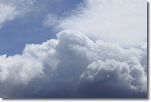
A nimbostratus cloud is similar to a stratus cloud in its formless,
smooth appearance. However, a nimbostratus cloud is darker than a stratus cloud,
because it is thicker.
Unlike a stratus cloud, a nimbostratus cloud typically brings with it the threat
of moderate to heavy precipitation. In some cases, the precipitation may evaporate
before reaching the ground, a phenomenon known as virga.
Next Topic: Precipitation
Current conditions powered by WeatherAPI.com


