Weather Alert in New Mexico
Flash Flood Warning issued August 25 at 2:24PM MDT until August 25 at 4:30PM MDT by NWS Albuquerque NM
AREAS AFFECTED: San Miguel, NM
DESCRIPTION: At 224 PM MDT, Doppler radar indicated thunderstorms producing heavy rain over the Hermits Peak and Calf Canyon Burn Scar. Between 1 and 2 inches of rain have fallen. Flash flooding is ongoing or expected to begin shortly. Excessive rainfall over the burn scar will impact Manuelitas Creek, the Sapello River, Tecolote Creek and the Gallinas River. The debris flow can consist of rock, mud, vegetation and other loose materials. HAZARD...Life threatening flash flooding. Thunderstorms producing flash flooding in and around the Hermits Peak and Calf Canyon Burn Scar. SOURCE...Radar indicated. IMPACT...Life threatening flash flooding of areas in and around the Hermits Peak and Calf Canyon Burn Scar. Some locations that will experience flash flooding include... El Porvenir, Montezuma, Sapello, Tierra Monte, Gallinas, Mineral Hill, Rociada, Manuelitas and San Geronimo. The heaviest rains so far have focused over the upper portions of the Gallinas Creek and Porvenir Canyon.
INSTRUCTION: This is a life threatening situation. Heavy rainfall will cause extensive and severe flash flooding of creeks, streams and ditches in the Hermits Peak and Calf Canyon Burn Scar. Severe debris flows can also be anticipated across roads. Roads and driveways may be washed away in places. If you encounter flood waters, climb to safety.
Want more detail? Get the Complete 7 Day and Night Detailed Forecast!
Current U.S. National Radar--Current
The Current National Weather Radar is shown below with a UTC Time (subtract 5 hours from UTC to get Eastern Time).

National Weather Forecast--Current
The Current National Weather Forecast and National Weather Map are shown below.

National Weather Forecast for Tomorrow
Tomorrow National Weather Forecast and Tomorrow National Weather Map are show below.

North America Water Vapor (Moisture)
This map shows recent moisture content over North America. Bright and colored areas show high moisture (ie, clouds); brown indicates very little moisture present; black indicates no moisture.

Weather Topic: What are Cumulus Clouds?
Home - Education - Cloud Types - Cumulus Clouds
 Next Topic: Drizzle
Cumulus clouds are fluffy and textured with rounded tops, and
may have flat bottoms. The border of a cumulus cloud
is clearly defined, and can have the appearance of cotton or cauliflower.
Cumulus clouds form at low altitudes (rarely above 2 km) but can grow very tall,
becoming cumulus congestus and possibly the even taller cumulonimbus clouds.
When cumulus clouds become taller, they have a greater chance of producing precipitation.
Next Topic: Drizzle
Weather Topic: What is Evaporation?
Home - Education - Precipitation - Evaporation
 Next Topic: Fog
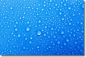
Evaporation is the process which returns water from the earth
back to the atmosphere, and is another crucial process in the water cycle.
Evaporation is the transformation of liquid into gas, and it happens because
molecules are excited by the application of energy and turn into vapor.
In order for water to evaporate it has to be on the surface of a body of water.
Next Topic: Fog
Current conditions powered by WeatherAPI.com


