Weather Alert in Michigan
Special Weather Statement issued February 25 at 4:43AM EST by NWS Gaylord MI
AREAS AFFECTED: Emmet; Cheboygan; Presque Isle; Leelanau; Antrim; Otsego; Montmorency; Benzie; Grand Traverse; Kalkaska; Crawford; Oscoda; Manistee; Wexford; Missaukee; Roscommon; Western Chippewa; Central Chippewa; Western Mackinac; Beaver Island and surrounding islands; Charlevoix
DESCRIPTION: Commutes this morning will be impacted by lake effect snow showers across much of northern lower and eastern upper Michigan. Reduced visibility (at times below one mile) from falling and blowing snow is likely along with snow-covered roads... both from snow yesterday evening and snow actively falling. Be sure to give yourself some extra time for the morning commute, and increase your following distance between yourself and the vehicle in front of you. When encountering reduced visibility, be sure to utilize low-beam headlights in order to make yourself more visible to other motorists.
INSTRUCTION: N/A
Want more detail? Get the Complete 7 Day and Night Detailed Forecast!
Current U.S. National Radar--Current
The Current National Weather Radar is shown below with a UTC Time (subtract 5 hours from UTC to get Eastern Time).

National Weather Forecast--Current
The Current National Weather Forecast and National Weather Map are shown below.

National Weather Forecast for Tomorrow
Tomorrow National Weather Forecast and Tomorrow National Weather Map are show below.

North America Water Vapor (Moisture)
This map shows recent moisture content over North America. Bright and colored areas show high moisture (ie, clouds); brown indicates very little moisture present; black indicates no moisture.

Weather Topic: What are Cumulus Clouds?
Home - Education - Cloud Types - Cumulus Clouds
 Next Topic: Drizzle
Cumulus clouds are fluffy and textured with rounded tops, and
may have flat bottoms. The border of a cumulus cloud
is clearly defined, and can have the appearance of cotton or cauliflower.
Cumulus clouds form at low altitudes (rarely above 2 km) but can grow very tall,
becoming cumulus congestus and possibly the even taller cumulonimbus clouds.
When cumulus clouds become taller, they have a greater chance of producing precipitation.
Next Topic: Drizzle
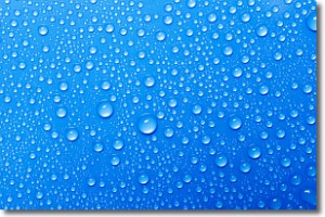
Weather Topic: What is Evaporation?
Home - Education - Precipitation - Evaporation
 Next Topic: Fog
Evaporation is the process which returns water from the earth
back to the atmosphere, and is another crucial process in the water cycle.
Evaporation is the transformation of liquid into gas, and it happens because
molecules are excited by the application of energy and turn into vapor.
In order for water to evaporate it has to be on the surface of a body of water.
Next Topic: Fog
Current conditions powered by WeatherAPI.com


