Weather Alert in California
Flood Watch issued September 1 at 12:24PM PDT until September 3 at 11:00PM PDT by NWS Los Angeles/Oxnard CA
AREAS AFFECTED: Western San Gabriel Mountains and Highway 14 Corridor; Eastern San Gabriel Mountains; Western Antelope Valley Foothills; Eastern Antelope Valley Foothills; Antelope Valley
DESCRIPTION: * WHAT...Flooding caused by excessive rainfall is possible. * WHERE...Northeastern Los Angeles County, including the following areas, Bridge Fire Burn Scar, Antelope Valley, Antelope Valley Foothills, San Gabriel Mountains, and Highway 14 Corridor. * WHEN...From late Tuesday morning through Wednesday evening. * IMPACTS...Flooding from thunderstorms and showers may occur in poor drainage and urban areas. Peak rain rates may reach 0.5 to 1.0 inch per hour. * ADDITIONAL DETAILS... - Increasing moisture and instability combined with slow moving storms will pose an increased risk of flash flooding. Strong outflow winds will be possible with thunderstorms, with locally damaging gusts to 60 mph possible. - http://www.weather.gov/safety/flood
INSTRUCTION: You should monitor later forecasts and be alert for possible Flood Warnings. Those living in areas prone to flooding should be prepared to take action should flooding develop.
Want more detail? Get the Complete 7 Day and Night Detailed Forecast!
Current U.S. National Radar--Current
The Current National Weather Radar is shown below with a UTC Time (subtract 5 hours from UTC to get Eastern Time).

National Weather Forecast--Current
The Current National Weather Forecast and National Weather Map are shown below.

National Weather Forecast for Tomorrow
Tomorrow National Weather Forecast and Tomorrow National Weather Map are show below.

North America Water Vapor (Moisture)
This map shows recent moisture content over North America. Bright and colored areas show high moisture (ie, clouds); brown indicates very little moisture present; black indicates no moisture.

Weather Topic: What are Cumulus Clouds?
Home - Education - Cloud Types - Cumulus Clouds
 Next Topic: Drizzle
Cumulus clouds are fluffy and textured with rounded tops, and
may have flat bottoms. The border of a cumulus cloud
is clearly defined, and can have the appearance of cotton or cauliflower.
Cumulus clouds form at low altitudes (rarely above 2 km) but can grow very tall,
becoming cumulus congestus and possibly the even taller cumulonimbus clouds.
When cumulus clouds become taller, they have a greater chance of producing precipitation.
Next Topic: Drizzle
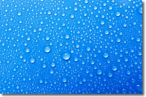
Weather Topic: What is Evaporation?
Home - Education - Precipitation - Evaporation
 Next Topic: Fog
Evaporation is the process which returns water from the earth
back to the atmosphere, and is another crucial process in the water cycle.
Evaporation is the transformation of liquid into gas, and it happens because
molecules are excited by the application of energy and turn into vapor.
In order for water to evaporate it has to be on the surface of a body of water.
Next Topic: Fog
Current conditions powered by WeatherAPI.com


