Weather Alert in North Carolina
Flood Advisory issued September 6 at 4:01PM EDT until September 6 at 6:00PM EDT by NWS Greenville-Spartanburg SC
AREAS AFFECTED: Cleveland, NC
DESCRIPTION: * WHAT...Urban and small stream flooding caused by excessive rainfall is expected. * WHERE...A portion of Cleveland County, North Carolina. * WHEN...Until 600 PM EDT. * IMPACTS...Minor flooding in low-lying and poor drainage areas. Ponding of water in urban or other areas is occurring or is imminent. Some roads may cover with water. * ADDITIONAL DETAILS... - At 401 PM EDT, Doppler radar indicated persistent heavy rain due to thunderstorms since early afternoon. This will cause urban and small stream flooding. Between 1 and 2 inches of rain have fallen. - Additional rainfall amounts of 1 to 2 inches are expected over the area. This additional rain will worsen any minor flooding and may cause new areas of flooding to develop. - Some locations that will experience flooding include... Shelby, Boiling Springs NC, Patterson Springs, Lattimore and Mooresboro. - http://www.weather.gov/safety/flood
INSTRUCTION: When it is safe to do so, please report flooding or landslides threatening roads or property to the National Weather Service Greenville-Spartanburg by calling toll free, 1, 800, 2 6 7, 8 1 0 1, by posting on our Facebook page, or via X using hashtag NWSGSP. Your message should describe the specific location where impacts occurred and the depth of flooding observed. Turn around, don't drown when encountering flooded roads. Most flood deaths occur in vehicles.
Want more detail? Get the Complete 7 Day and Night Detailed Forecast!
Current U.S. National Radar--Current
The Current National Weather Radar is shown below with a UTC Time (subtract 5 hours from UTC to get Eastern Time).

National Weather Forecast--Current
The Current National Weather Forecast and National Weather Map are shown below.

National Weather Forecast for Tomorrow
Tomorrow National Weather Forecast and Tomorrow National Weather Map are show below.

North America Water Vapor (Moisture)
This map shows recent moisture content over North America. Bright and colored areas show high moisture (ie, clouds); brown indicates very little moisture present; black indicates no moisture.

Weather Topic: What are Hole Punch Clouds?
Home - Education - Cloud Types - Hole Punch Clouds
 Next Topic: Mammatus Clouds
A hole punch cloud is an unusual occurrence when a disk-shaped
hole appears in a cirrostratus, cirrocumulus, or altocumulus cloud.
When part of the cloud forms ice crystals, water droplets in the surrounding area
of the cloud evaporate. The effect of this process produces a large elliptical
gap in the cloud. The hole punch cloud formation is rare, but it is not specific
to any geographic area.
Other names which have been used to describe this phenomena include fallstreak hole,
skypunch, and cloud hole.
Next Topic: Mammatus Clouds
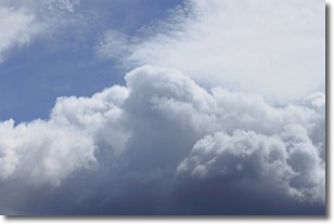
Weather Topic: What are Nimbostratus Clouds?
Home - Education - Cloud Types - Nimbostratus Clouds
 Next Topic: Precipitation
A nimbostratus cloud is similar to a stratus cloud in its formless,
smooth appearance. However, a nimbostratus cloud is darker than a stratus cloud,
because it is thicker.
Unlike a stratus cloud, a nimbostratus cloud typically brings with it the threat
of moderate to heavy precipitation. In some cases, the precipitation may evaporate
before reaching the ground, a phenomenon known as virga.
Next Topic: Precipitation
Current conditions powered by WeatherAPI.com


