Weather Alerts for California
1. Air Quality Alert for: Coachella Valley
2. Beach Hazards Statement for: Coastal North Bay Including Point Reyes National Seashore; Northern Monterey Bay
3. Beach Hazards Statement for: Ventura County Beaches; Malibu Coast; Los Angeles County Beaches
4. Extreme Heat Warning for: Coachella Valley; San Diego County Deserts
5. Extreme Heat Warning for: Indian Wells Valley; Mojave Desert Slopes; Mojave Desert
6. Extreme Heat Warning for: San Gorgonio Pass Near Banning
7. Extreme Heat Warning for: Western Antelope Valley Foothills; Eastern Antelope Valley Foothills; Antelope Valley
8. Extreme Heat Warning for: Western Siskiyou County; Central Siskiyou County
9. Heat Advisory for: Cuyama Valley; Santa Ynez Mountains Eastern Range; Santa Barbara County Interior Mountains; Southern Ventura County Mountains; Northern Ventura County Mountains; Interstate 5 Corridor; Western San Gabriel Mountains and Highway 14 Corridor; Eastern San Gabriel Mountains
10. Heat Advisory for: North Central and Southeast Siskiyou County; Northeast Siskiyou and Northwest Modoc Counties; Modoc County; Klamath Basin
11. Heat Advisory for: Northern Humboldt Interior
12. Heat Advisory for: Northern Trinity
13. Heat Advisory for: Riverside County Mountains; San Diego County Mountains
14. Heat Advisory for: San Bernardino and Riverside County Valleys-The Inland Empire
15. Heat Advisory for: San Bernardino County Mountains
16. Heat Advisory for: Santa Ynez Mountains Western Range
17. Heat Advisory for: South Central Siskiyou County
18. Heat Advisory for: Surprise Valley California; Lassen-Eastern Plumas-Eastern Sierra Counties; Mineral and Southern Lyon Counties; Greater Reno-Carson City-Minden Area; Western Nevada Basin and Range including Pyramid Lake; Northern Washoe County
19. Heat Advisory for: West Side Mountains north of 198; Los Banos - Dos Palos; Merced - Madera - Mendota; Planada - Le Grand - Snelling; Coalinga - Avenal; West Side of Fresno and Kings Counties; Caruthers - San Joaquin - Selma; Fresno-Clovis; West Side Mountains South of 198; Buttonwillow - Lost Hills - I5; Delano-Wasco-Shafter; Hanford - Corcoran - Lemoore; Visalia - Porterville - Reedley; Buena Vista; Bakersfield; Southeast San Joaquin Valley; South End San Joaquin Valley; Mariposa Madera Foothills; Fresno-Tulare Foothills; South End Sierra Foothills
20. Wind Advisory for: Santa Barbara County Southwestern Coast
21. Wind Advisory for: Santa Ynez Mountains Western Range
Want more detail? Get the Complete 7 Day and Night Detailed Forecast!
Current U.S. National Radar--Current
The Current National Weather Radar is shown below with a UTC Time (subtract 5 hours from UTC to get Eastern Time).

National Weather Forecast--Current
The Current National Weather Forecast and National Weather Map are shown below.

National Weather Forecast for Tomorrow
Tomorrow National Weather Forecast and Tomorrow National Weather Map are show below.

North America Water Vapor (Moisture)
This map shows recent moisture content over North America. Bright and colored areas show high moisture (ie, clouds); brown indicates very little moisture present; black indicates no moisture.

Weather Topic: What are Cirrostratus Clouds?
Home - Education - Cloud Types - Cirrostratus Clouds
 Next Topic: Cirrus Clouds
Cirrostratus clouds are high, thin clouds that form above
20,000 feet and are made mostly of ice crystals. They sometimes look like giant
feathers, horse tails, or curls of hair in the sky.
These clouds are pushed by the jet stream and can move at high speeds reaching
100 mph.
What do they indicate?
They indicate that a precipitation is likely within 24 hours.
Next Topic: Cirrus Clouds
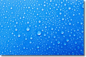
Weather Topic: What is Condensation?
Home - Education - Precipitation - Condensation
 Next Topic: Contrails
Condensation is the process which creates clouds, and therefore
it is a crucial process in the water cycle.
Condensation is the change of matter from a state of gas into a state of liquid,
and it happens because water molecules release heat into the atmosphere and
become organized into a more closely packed structure, what we might see as
water droplets.
Water is always present in the air around us as a vapor, but it's too small for
us to see. When water undergoes the process of condensation it becomes organized
into visible water droplets. You've probably seen condensation happen before on the
surface of a cold drink!
Next Topic: Contrails
Current conditions powered by WeatherAPI.com


